
Staveley Solar Farm is a new solar energy project being developed by TotalEnergies, and Anglian Water, the local water supplier.
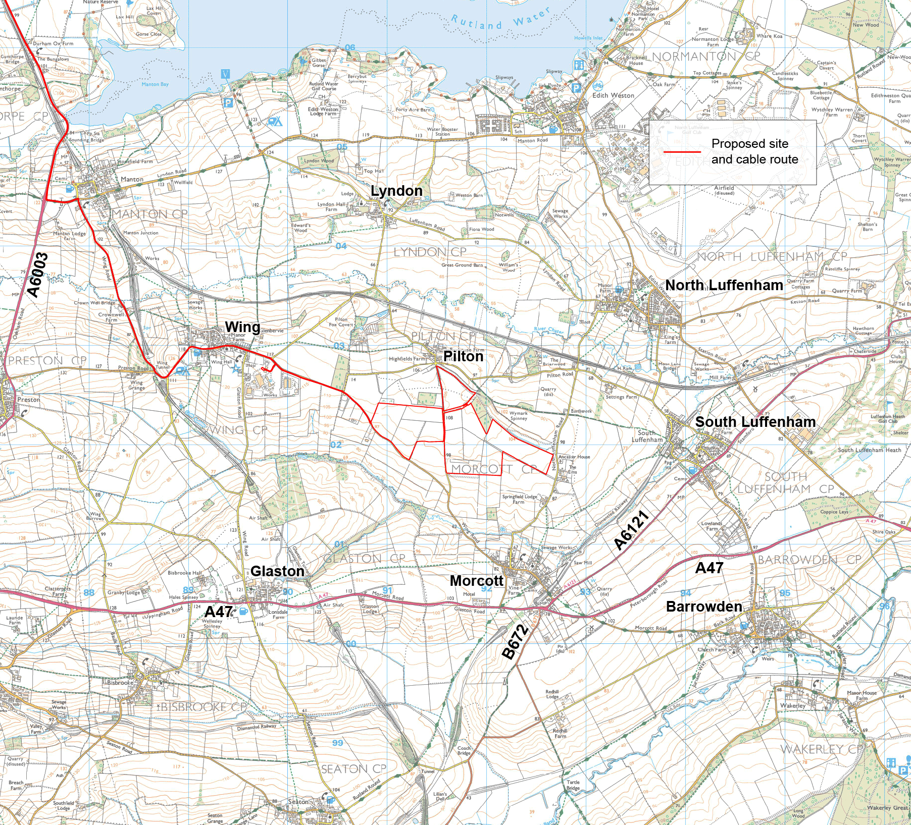
The site is located on land to the south of Pilton and comprises approximately 80 hectares (ha) of a 1,565-ha landholding, previously used for ironstone quarrying operations.
If Staveley Solar Farm is granted consent, it would help to provide clean, sustainable energy to Rutland’s water supply and contribute to local and national net zero targets.
Approximately 90% of the electricity generated by the solar farm will be used by Anglian Water, the local water supplier, to decarbonise their operations, and of which 10-15% will be utilised at the Wing Water Treatment Works via a ‘direct wire’. The remaining energy generated would be exported to the National Grid.
Designed with the future in mind, Staveley Solar Farm would also allow sheep grazing to continue, supporting farm diversification and long-term food production.
TotalEnergies’ ambition is to be a world-class player in leading the energy transition and achieving carbon neutrality by 2050, together with society.
TotalEnergies are working with Anglian Water to help achieve the latter’s ambitious target of 45% renewable energy generation by 2025 and to become a net zero organisation by 2030. Incorporating renewable energy sources such as Staveley Solar Farm will be needed to meet this challenge and bring Rutland one step closer to achieving net zero.
The site for the proposed Solar Farm is situated on brownfield land with poor soil quality. The vision for the project is to take this site of comparatively low environmental and agricultural value and enhance it to ensure biodiversity can flourish and sheep can graze on the site.
About TotalEnergies in the UK
TotalEnergies has been present in the UK for more than 60 years, employing more than 1,800 people across the energy value chain.
We are one of the country’s leading oil and gas operators, operating around 30% of the UK Continental Shelf’s gas production, with average daily equity production of 142,000 barrels of oil equivalent per day (boe/d) in 2023.
We’re diversifying our energy offering to provide decarbonised and renewable energies to our customers, while continuing to provide the oil and gas they need today.
We have invested in several offshore wind developments in the UK which will have the capacity to deliver over 5GW of renewable power this decade, including Seagreen (1.1GW) which became fully operational in October 2023, West of Orkney (2GW) and Outer Dowsing (1.5 GW).
We are one of the UK’s largest suppliers of gas and electricity to businesses and the public sector. We also offer electric vehicle charging solutions and markets petroleum products including lubricants, aviation fuel, bitumen and specialty fluids.
About TotalEnergies
TotalEnergies is a global multi-energy company that produces and markets energies: oil and biofuels, natural gas and green gases, renewables and electricity.
Our team of more than 100,000 employees are committed to energy that is ever more affordable, more sustainable, more reliable and accessible to as many people as possible.
Active in nearly 130 countries, TotalEnergies puts sustainable development in all its dimensions at the heart of its projects and operations to contribute to the well-being of people.
About Anglian Water
Anglian Water is the largest water and water recycling company in England and Wales by geographic area. It supplies water and water recycling services to almost seven million people in the East of England and Hartlepool. Its purpose, enshrined in the company values, is to bring environmental and social prosperity to the region.
About Pegasus Group
Pegasus Group is a leading independent development consultancy, operating throughout the UK. Pegasus Group are the Planning Agent for Staveley Solar Farm; their role involves guiding the project through the planning process, co-ordinating technical expertise and ensuring compliance with local and national regulations. Their expertise ensures that the development aligns with both community needs and environmental standards.
The Site is located on land to the south of Pilton Village, Luffenham Lane, Pilton, in Rutland, and comprises approximately 80 hectares (ha) of a 1,380ha landholding, historically used for ironstone quarrying operations. Additionally, no designated heritage assets lie within the site.
The maps above and below show the design that was submitted to Rutland County Council as part of our planning application.
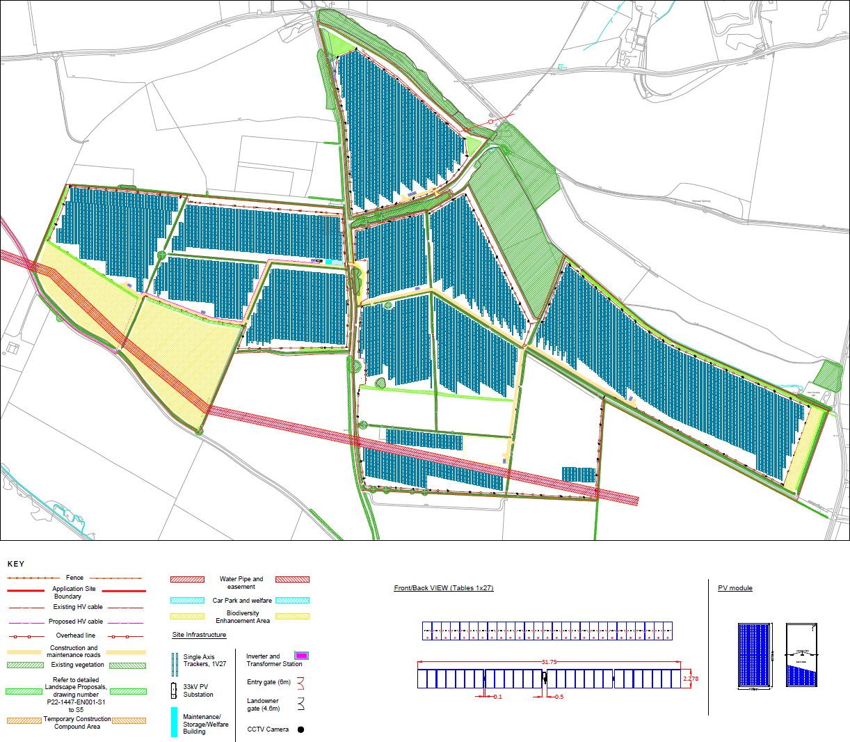
The feedback we received during our public consultation in 2023 has helped shape the plans that we submitted to Rutland County Council in our planning application. This design also reflects pre-application advice we have received from Rutland County Council as the Local Planning Authority on planning policy which we are required to adhere to.
The feedback received during our public consultation, and how this has been taken into account within our final designs, is summarised in our Statement of Community Involvement and You Said, We Did document.
To view our planning application, and these documents, please click on the link here. The planning application number is 2024/0300/MAF.
We have listened to your feedback on our proposed Community Benefit Fund and have increased our monetary offering. If you would like to find out more information or wish to submit ideas, this can be found on our Community Benefit page.
The Staveley Solar Farm project enables farm diversification. Approximately 95% of the site will remain available for sheep grazing, allowing farmers to maintain their agricultural operations alongside the solar panels. This dual-use approach supports sustainable farming practices and provides farmers with a diversified and stable income stream.
The National Farmers Union support solar schemes such as this project as it allows farms to diversify which in turn helps keeps farmers in business, allows farmers to continue to farm sustainably, employs local people and provides investments locally, whilst improving the land and soil quality for future generations to come.
The project contributes to improving soil quality and fostering carbon sequestration through the establishment of diverse, flower-rich habitats that support pollinators. This integration of solar energy production with agriculture helps to ensure long-term land fertility while promoting biodiversity and enhancing local ecosystems.
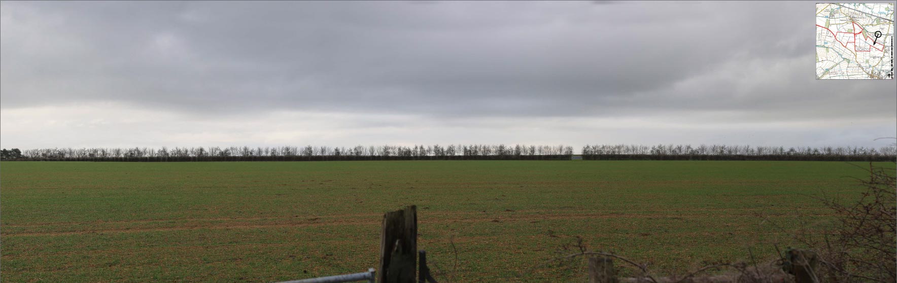
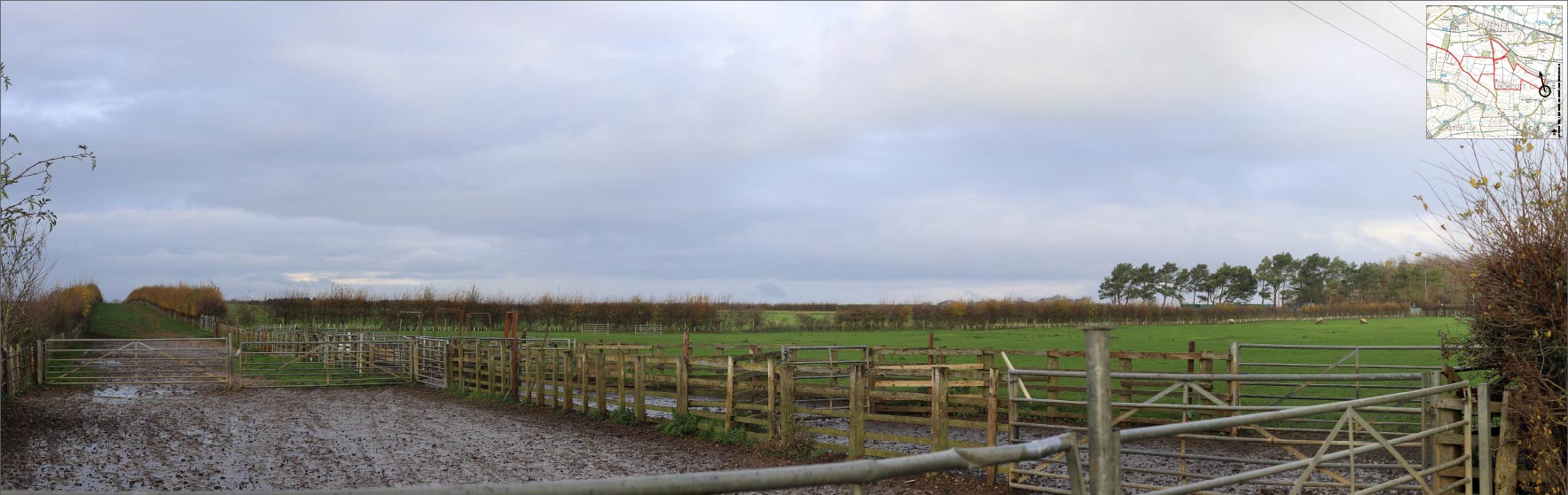
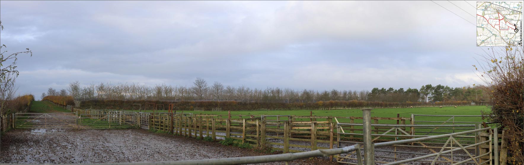
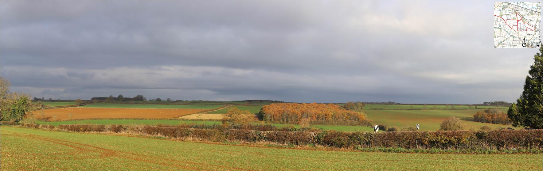
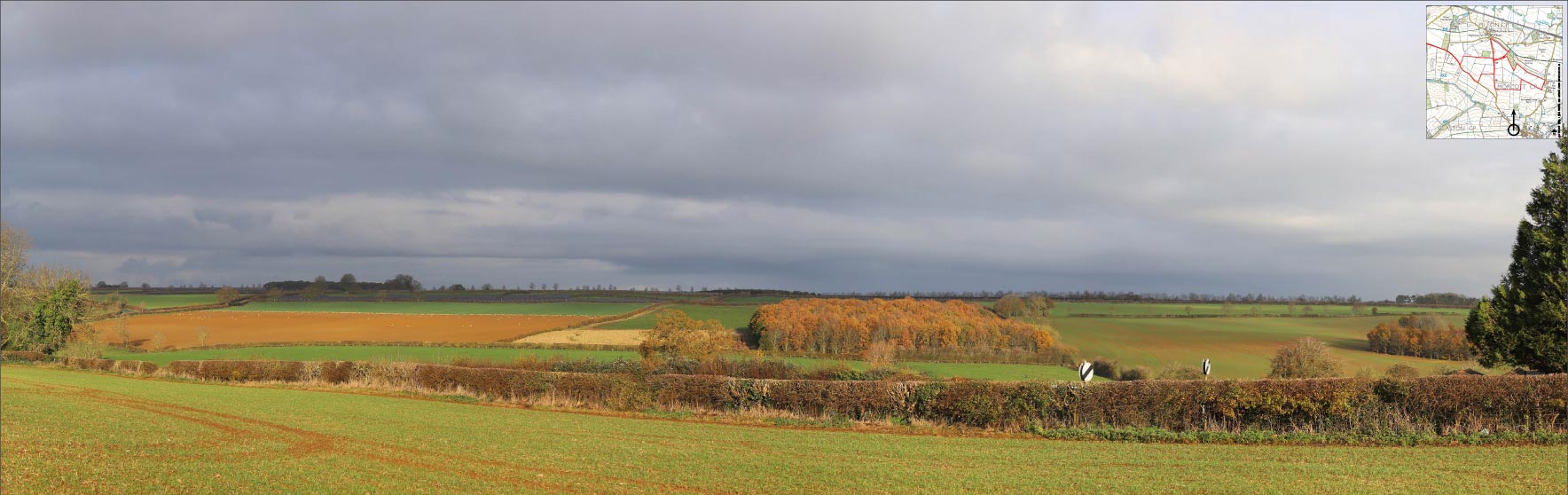
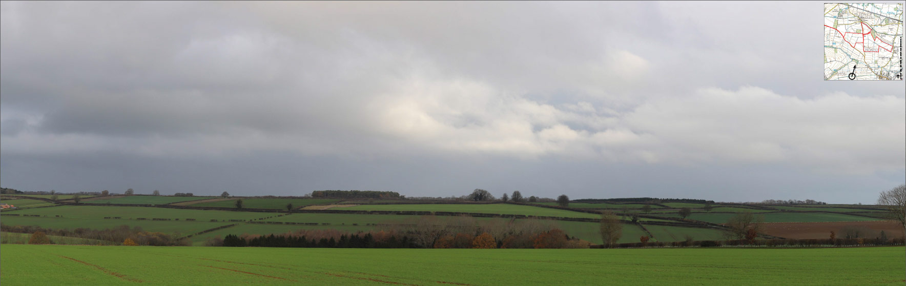
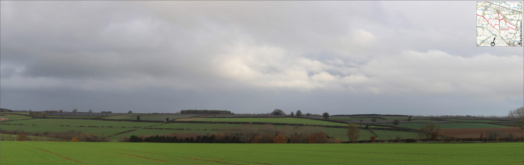
The images below show viewpoints of the site from different locations, showing how they will look during the 1st and 15th year during operation. These viewpoints have been set-up to represent an open view across the site during winter and therefore a ‘worst case’.
1. Viewpoint 4 – Bridleway E279 west of North Luffenham Road.
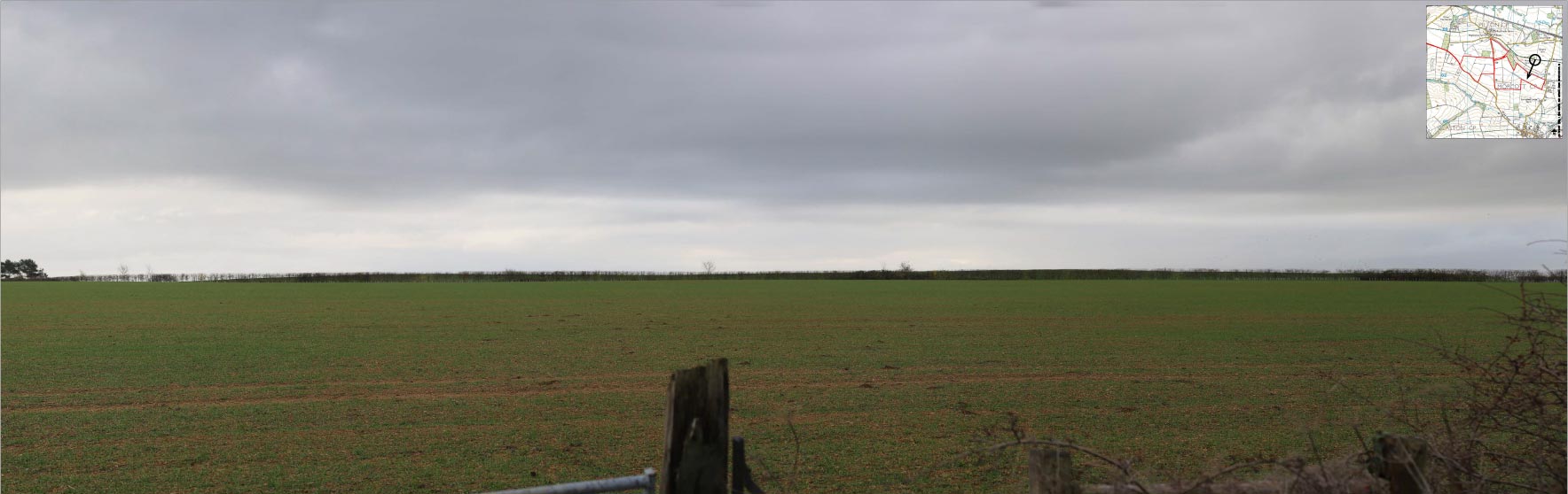
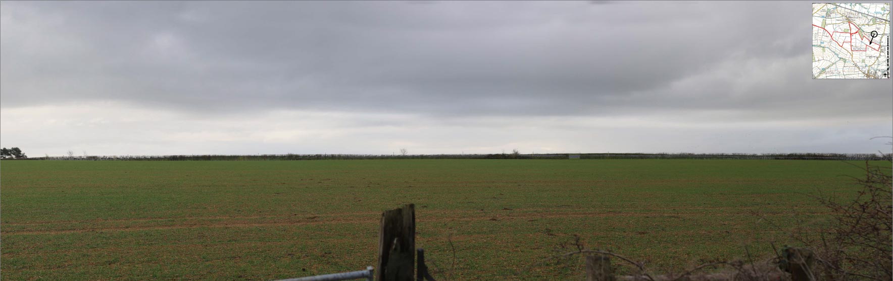
2. Viewpoint 5 – North Luffenham Road, near residential properties, looking northwest.
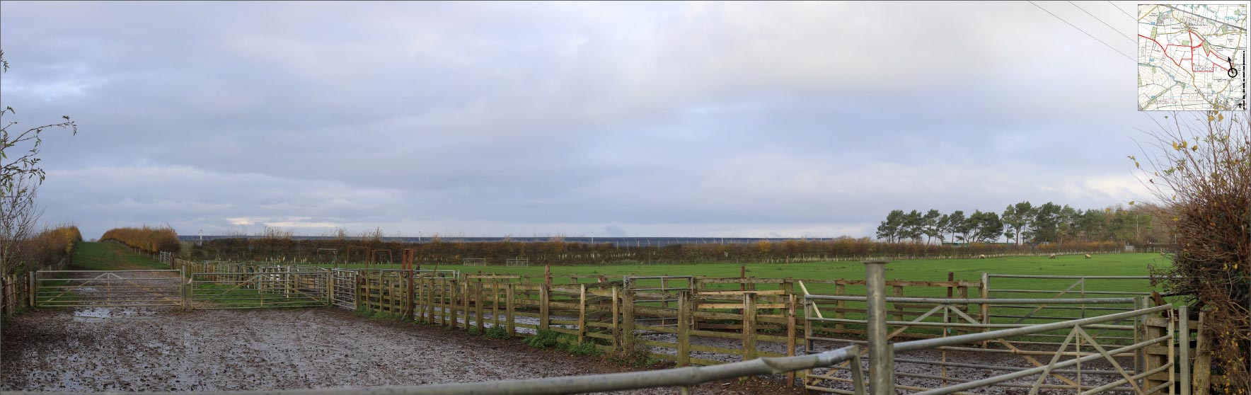
3. Viewpoint 6 – Public Right of Way (PRoW) near the western edge of Morcott, looking northwest to northeast.

4. Viewpoint 7 – The central part of the Public Right of Way (PRoW) between Wing Road in the east and the A47 Morcott Road in the southwest, looking northwest to northeast.

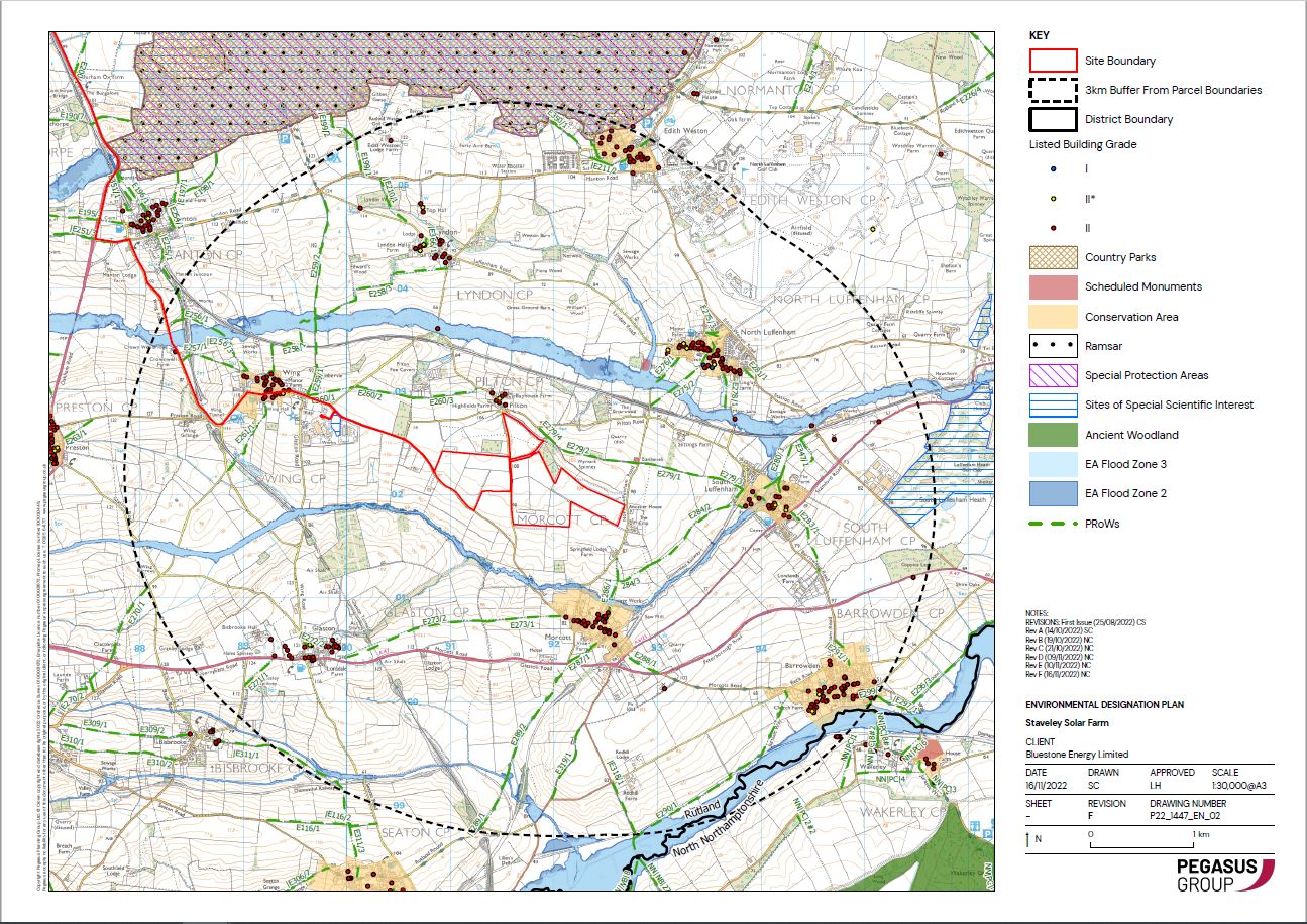
The map below shows where there are Special Protection Areas in nearby proximity to the proposed site.
Earlier this year, we submitted our planning application to Rutland County Council.
There is still time to have your say on the plans via the Council’s website before the Planning and Licensing Committee makes a decision on the application later this year.
If you wish to comment on Staveley Solar Farm’s planning application, a link can be found here. The planning application number is 2024/0300/MAF.